

The actual reasons for this reversal are not known exactly, but it is possible that traffic congestion on the existing Middlesex Freeway (I-287) prompted the NJDOT to consider a new parallel freeway instead of attempting to widen the existing one. Additionally, the tight right-of-way (ROW) near the previously adopted junction near current Exit 10 was likely a cause of concern due to the increased costs for interchange construction and the decreased design speeds that would result from building the junction in that location. Finally, the existing Middlesex Freeway (I-287) bridge over the Raritan River between current Exit 10 and Exit 9 would likely have required a complete replacement to facilitate traffic to and from the Somerset Freeway (I-95), a project that the NJDOT would likely have wanted to put off for as long as possible.
At the south end, the "Trenton Beltway" concept for the Scudders Falls Expressway (I-95) and the Camden Freeway (I-295) was by now fully developed, and now show a smooth transition from the Scudders Falls Expressway (I-95) to the Camden Freeway (I-295) and vice versa.
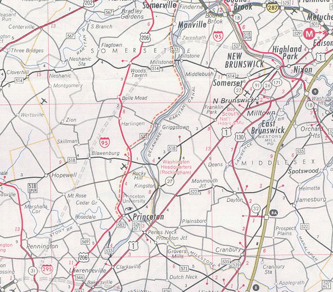
Finally, protests from the Princetons had now been acknowledged and the Somerset Freeway (I-95) had been realigned to pass west of Princeton Township instead of through it. However, spurred by the Princetons' rejection of the road, the neighboring townships of Montgomery and Hopewell now began to protest the route that now passed solely through their lands.
Map 1: I-95 Corridor Shifts, 1954 - 1982
Map 2: Adopted Route, 1964
Map 3: Re-extended Route, 1968
Map 4: Connectors Added, 1976
Map 5: All Considered Alignments, 1979
Map 6: Preferred Alternative Schematics and Exit List, 1979
Map 7: Exit Number Changes, 1984 - 1996
Map 8: I-95 Gap Corridor Today
Map 9: The Future I-95/I-276 Interchange
The I-95 Gap Eastern Bypass
The I-95 Eastern Route
The I-95 Western Route
The I-95 Gap Western Bypass
Back to New Jersey Expressways and Tollways