
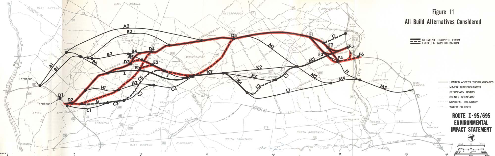
The various alignments were evaluated based on impacts and then gradually dropped from consideration. The thin lines were dropped first, and then the thick, non-reddened lines. The thick reddened lines were the alignments which remained and were the 'preferred alternatives' of the DEIS. Note that most of the original alignment from 1972 remained as a preferred alternative.
Some interesting proposals here include the alternate intersection with the exisiting Scudders Falls Expressway (I-95) near Exit 3, as well as the far northwesterly and southwesterly alignments. Note that the alignment extending into Piscataway Township was quickly dropped, resulting in all alternatives having termini in the same area as the proposed Somerset Freeway Spur (I-695). This effectively eliminated a separate Somerset Freeway Spur (I-695) from plans.
Map 1: I-95 Corridor Shifts, 1954 - 1982
Map 2: Adopted Route, 1964
Map 3: Re-extended Route, 1968
Map 4: Connectors Added, 1976
Map 5: All Considered Alignments, 1979
Map 6: Preferred Alternative Schematics and Exit List, 1979
Map 7: Exit Number Changes, 1984 - 1996
Map 8: I-95 Gap Corridor Today
Map 9: The Future I-95/I-276 Interchange
The I-95 Gap Eastern Bypass
The I-95 Eastern Route
The I-95 Western Route
The I-95 Gap Western Bypass
Back to New Jersey Expressways and Tollways