
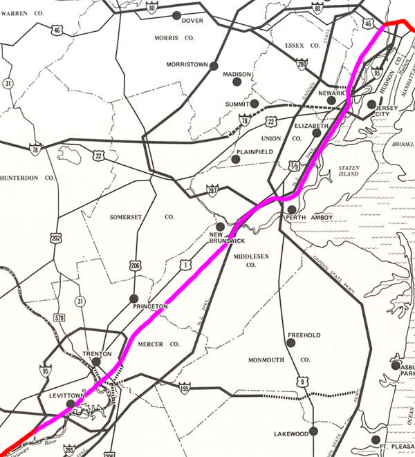

While the turnpike authority pushed the road further west of the turnpike in central New Jersey as it had hoped to, I-95 was no longer part of the turnpike in northern New Jersey. This reversed the 1957 change and again posed a serious threat to its toll revenue capabilities. At the same time, the proposal of constructing a large freeway through sections of Elizabeth, Newark, and many other nearby developed communites was a threat to an unprecedented amount of private residences and businesses. Both concerns ensured that the "North Jersey Expressway" proposal would not survive very long.
By this time, the Bergen-Passaic Expressway (I-80 and I-95) between the George Wasington Bridge (I-95) and the proposed "North Jersey Expressway" junction was completed. It was the first section of freeway in New Jersey which was built as part of I-95 and not under another designation.
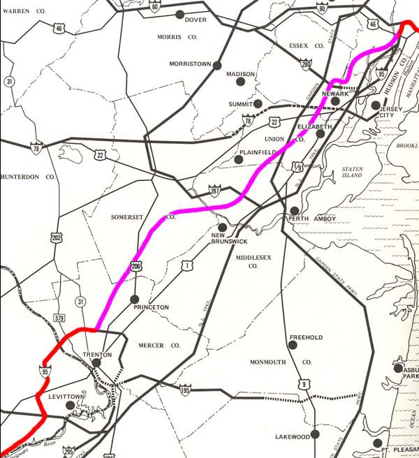
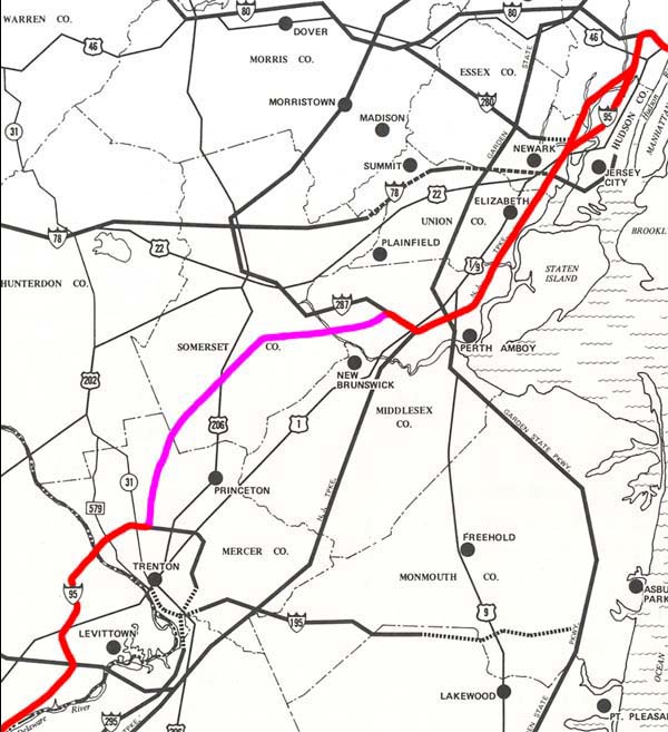
The "Somerset Freeway" now became a target for heavy protest from the local residents of Hopewell, Princeton, and Montgomery Townships in the southern section of its proposed alignment. Residents believed that the freeway would bring unprecedented development to what was then still a rural farming area, thereby destroying the rural character of the region. Additionally, it was feared that a large amount of traffic would use the freeway to bypass the tolled New Jersey Turnpike (then NJ 700) and the arterial New Brunswick-Metuchen Bypass (US 1) and Trenton-New Brunswick Turnpike (US 1), resulting in greatly increased air pollution along the freeway corridor. There were also several historic districts along the route which could have potentially been disturbed by the freeway's construction. Finally, residents near the freeway alignment's northern end in Piscataway Township believed the freeway would destroy the local neighborhoods which it was proposed to pass through. All of these concerns would eventually have an effect, but some would affect the road sooner than others.
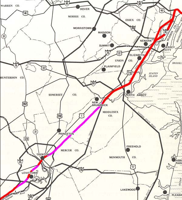
By this time, several more sections of the unbuilt I-95 corridor had been constructed as part of I-95 itself (and not under another designation). The New Jersey Department of Transportation had recently completed the New Jersey Turnpike Northern Extension (I-95), which finally connected the New Jersey Turnpike's original terminus at Winant Avenue (US 46) with the Bergen-Passaic Expressway (I-80 and I-95). This created a full freeway route between the New Jersey Turnpike (I-95) and the George Washington Bridge (I-95) for the first time. Additionally, the NJDOT had also completed the Middlesex Freeway Extension (then I-95 and NJ 440), which finally connected the Middlesex Freeway (then I-95) with the New Jersey Turnpike (then NJ 700 and I-95). The New Jersey Turnpike Authority had also doubled the capacity of the section of the turnpike which was designated as part of I-95, through the construction of the New Jersey Turnpike Western Spur (I-95) in the north and through the construction of the dual-dual car/truck roadway configuration between the end of the Western Spur and Exit 10.
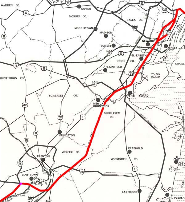
The final work on the I-95 alignment that was completed before the "Somerset Freeway" was cancelled included the completion of the Scudders Falls Expressway (I-95) directly southwest of the freeway's proposed southern terminus, and the section of the Camden Freeway (then I-295) directly southeast of the freeway's proposed southern terminus. This work included the creation of a 'ghost interchange' with unbuilt ramps at the proposed I-95/I-295 junction in southeastern Hopewell Township.
By this time, local protests against the "Somerset Freeway" had become regional protests and were backed by regional officials. The New Jersey Department of Transportation gradually became convinced of their inability to complete I-95 through New Jersey as planned.
This was the final proposal of I-95 through west central New Jersey.
Finishing this alignment's connections - via the I-95/I-276 interchange project - only started to be planned in the early 1990's and continues to be planned to this day.
It can be understood that the New Jersey Turnpike Authority would not have liked the routing of a free expressway so close and parallel to the tolled turnpike, lest they should loose large sums of revenue to a parallel free road.
Even with this new change bringing the northern section of I-95 onto the turnpike, the central and southern section still closely paralleled the turnpike without actually being a part of it. This would have necesitated the construction of a parallel free expressway, which therefore still threatened the turnpike's ability to collect adequate revenue.
Meanwhile, Highway Department officials would also become concerned with the 'incompatibility' of I-95 with the tolled nature of the turnpike, due to legal constraints in the legislation of the National System of Interstate and Defense Highways (Interstate Highway System). They would also become concerned with the ability of the Trenton Freeway (US 1) to carry the capacity required once it was designated as I-95, due to its narrow (4 lanes) and depressed configuration through downtown Trenton.
Map 1: I-95 Corridor Shifts, 1954 - 1982
Map 2: Adopted Route, 1964
Map 3: Re-extended Route, 1968
Map 4: Connectors Added, 1976
Map 5: All Considered Alignments, 1979
Map 6: Preferred Alternative Schematics and Exit List, 1979
Map 7: Exit Number Changes, 1984 - 1996
Map 8: I-95 Gap Corridor Today
Map 9: The Future I-95/I-276 Interchange
The I-95 Gap Eastern Bypass
The I-95 Eastern Route
The I-95 Western Route
The I-95 Gap Western Bypass
Back to New Jersey Expressways and Tollways