![]() |
![]() |
![]() |
![]() |
![]() |
![]() |
![]() |
![]() |
![]() |
![]() |
![]() |
![]() |
![]() |
![]() |
![]() |
![]() |
![]() |
![]() |
|
 |
|
|
 |
|
|
Storm description, surface observations, snowfall totals, and images courtesy of the National Climatic Data Center, the National Centers of Environmental Prediction, the Climate Prediction Center, the Hydrometeorological Prediction Center, the Mount Holly National Weather Service Office, the Upton National Weather Service Office, Rutgers University, Plymouth State University, the University of Illinois, the American Meteorological Society, Weather Graphics Technologies, AccuWeather, and the Weather Channel.
|
|
|
Table of Contents
Storm Summary
Regional Surface Observations
Satellite Imagery
Sea Level Pressure and 1000 to 500 Millibar Thickness Maps
850 Millibar Maps
700 Millibar Maps
500 Millibar Maps
300 Millibar Maps
200 Millibar Maps
|
|
|
 |
|
|
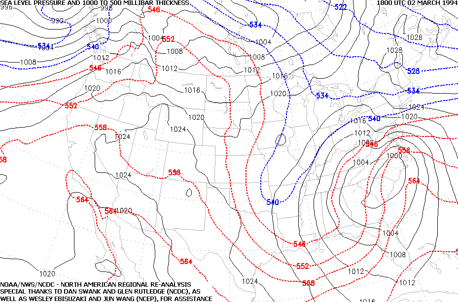
SLP and Thickness Map from 1800Z 02 March 1994 (1PM EST 02 March 1994)
|
|
|
 |
|
|
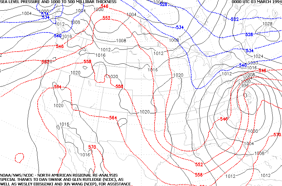
SLP and Thickness Map from 0000Z 03 March 1994 (7PM EST 02 March 1994)
|
|
|
 |
|
|
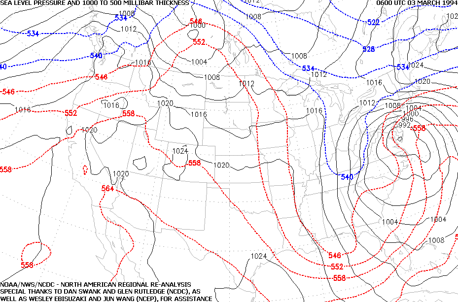
SLP and Thickness Map from 0600Z 03 March 1994 (1AM EST 03 March 1994)
|
|
|
 |
|
|
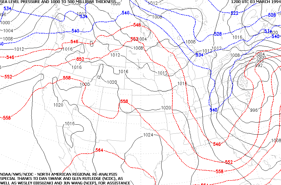
SLP and Thickness Map from 1200Z 03 March 1994 (7AM EST 03 March 1994)
|
|
|
 |
|
|
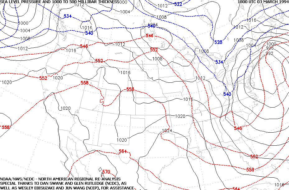
SLP and Thickness Map from 1800Z 03 March 1994 (1PM EST 03 March 1994)
|
|
|
 |
|
|
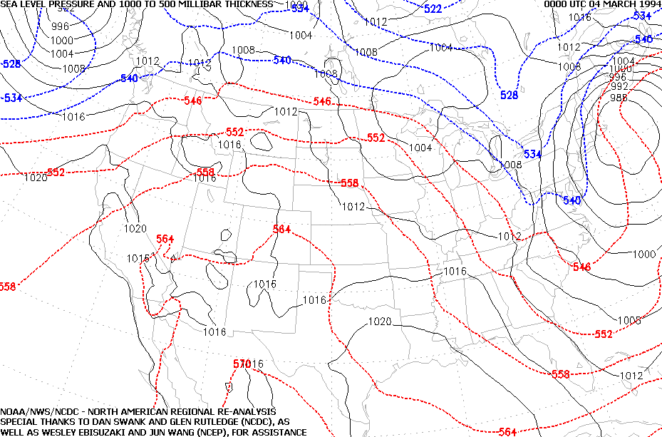
SLP and Thickness Map from 0000Z 04 March 1994 (7PM EST 03 March 1994)
|
|
|
Table of Contents
Storm Summary
Regional Surface Observations
Satellite Imagery
Sea Level Pressure and 1000 to 500 Millibar Thickness Maps
850 Millibar Maps
700 Millibar Maps
500 Millibar Maps
300 Millibar Maps
200 Millibar Maps
|
|
|
Snow storm, December 29-30, 1993
Ice storm, January 3-4, 1994
Ice storm, January 7-8, 1994
Snow and ice storm, January 17-18, 1994
Snow storm, January 25-26, 1994
Snow and ice storm, February 8-9, 1994
Snow and ice storm, February 11, 1994
Snow and ice storm, February 23-24, 1994
Snow and ice storm, March 2-3, 1994
Snow storm, March 18, 1994
Back to Ray's Winter Storm Archive |
|
|
Copyright © 2006 by Raymond C Martin Jr. All rights reserved |
|


